
The new tube map for June 2016 is here, and at Londonist we've got an exclusive first peek.
Open it up, and you'll see something straight away that is new — for the first time, TfL has added in the trams, even though they've been running since May 2000.
Who gets to decide what appears on the tube map, and why have the trams only just appeared now? That's what we really wanted to know too, so we went and met TfL's head designer Jon Hunter to talk about how new tube maps happen.
The blue wheelchair blob that was on the previous version of the map (January 2016) has now been taken off Vauxhall, as building works at the station are ongoing. They'll finish that lift soon... right?
Here's what the new map looks like (click to enlarge):
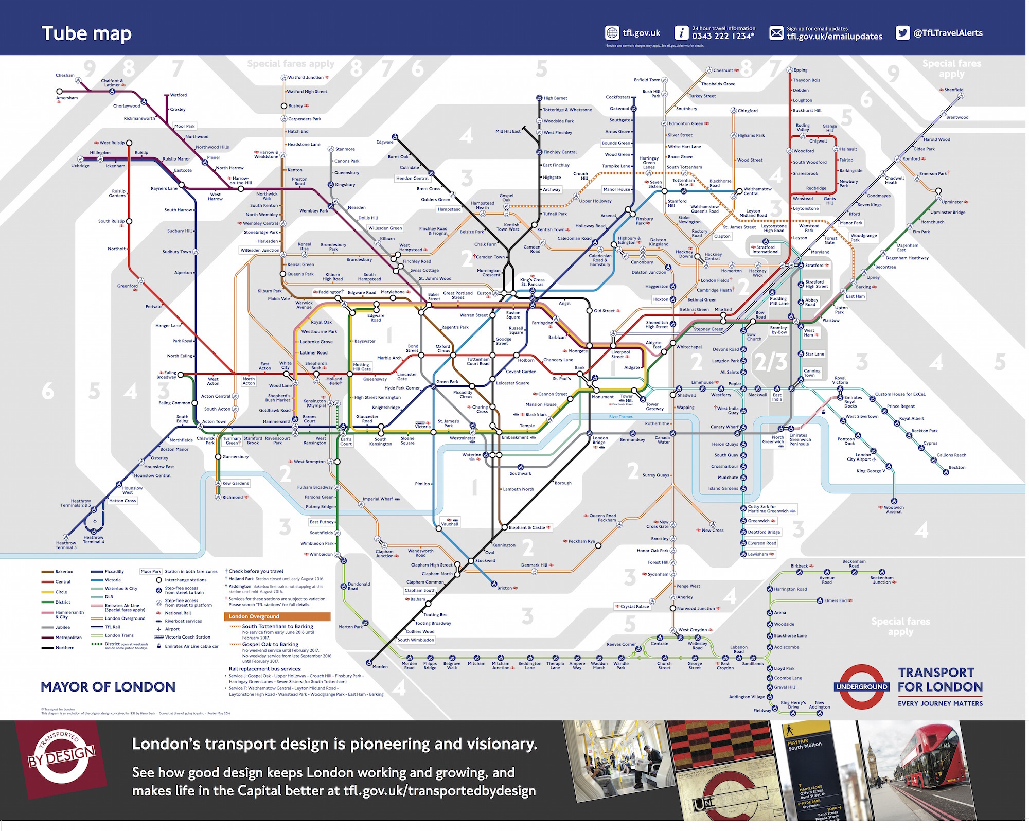
And there's a big change on one part of the Overground — the Gospel Oak to Barking (GOBLIN) line has now become dotted/pecked throughout to denote its closure over the next few months while the line is electrified.
You'll only be able to travel between Gospel Oak and South Tottenham (which now has lifts, by the way) on weekdays up until September — beyond South Tottenham to Barking it's closed, and then after September, no service will run at all across the entire line; replacement buses will operate.
With the addition of the trams (37 new stations, because Wimbledon and West Croydon were already on the map), this now brings the total number of stations on the map to 440.
Yet out of that only 238 of them are tube stations by themselves: the Overground, DLR, TfL Rail and now trams are all slowly taking over the map, meaning that only 60% of the tube map is actually just tube stations.
Is it time to re-name the tube map to reflect what it really is — the TfL services map?


